
Aventura 2 Plus
GPS TwoNav Aventura 2 Plus - A cutting-edge GPS with a large screen that’s resistant to extreme temperatures, perfect for extreme hiking and hiking. With a joystick and buttons to easily navigate maps. Includes topographic map.
One stop shop for complete navigation & communication solutions.
Garmin

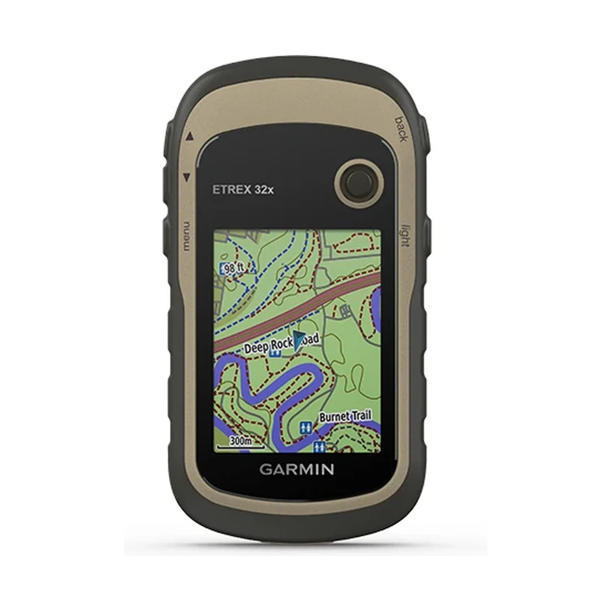
Explore Confidently with the Reliable Handheld GPS 2.2” sunlight-readable color display with 240 x 320 display pixels for improved readability Preloaded with TopoActive maps with routable roads and trails for cycling and hiking Support for GPS and GLONASS…
Technical
| Physical dimensions | 2.1″ x 4.0″ x 1.3″ (5.4 x 10.3 x 3.3 cm) |
|---|---|
| Display size | 1.4″ x 1.7″ (3.5 x 4.4 cm); 2.2″ diag (5.6 cm) |
| Display resolution | 240 x 320 pixels |
| Display type | 2.2″ transflective, 65K color TFT |
| Weight | 5 oz (141.7 g) with batteries |
| Battery type | 2 AA batteries (not included); NiMH or Lithium recommended |
| Battery life | 25 hours |
| Water rating | IPX7 |
| Interface | mini USB |
| Memory/History | 8 GB |
| Preloaded maps | yes (TopoActive; routable) |
| Map segments | 3000 |
| BirdsEye | 250 BirdsEye Imagery files |
| External memory storage | (32 GB max microSD™ card) |
| Waypoints/favorites/locations | 2000 |
| Tracks | 200 |
| Track log | 10000 points, 200 saved tracks |
| Routes | 200 routes, 250 points per route; 50 points auto routing |
| Compass | (tilt-compensated 3-axis) |
| Geocaching-friendly | (Paperless) |
| Custom maps compatible | (100 custom map tiles) |
| Wireless connectivity | yes (ANT+®) |
Overview
General |
|
| Physical dimensions | 2.1″ x 4.0″ x 1.3″ (5.4 x 10.3 x 3.3 cm) |
| Display size | 1.4″ x 1.7″ (3.5 x 4.4 cm); 2.2″ diag (5.6 cm) |
| Display resolution | 240 x 320 pixels |
| Display type | 2.2″ transflective, 65K color TFT |
| Weight | 5 oz (141.7 g) with batteries |
| Battery type | 2 AA batteries (not included); NiMH or Lithium recommended |
| Battery life | 25 hours |
| Water rating | IPX7 |
| High-sensitivity receiver | |
| Interface | mini USB |
| Memory/History | 8 GB |
Maps & Memory |
|
| Preloaded maps | yes (TopoActive; routable) |
| Ability to add maps | |
| Basemap | |
| Automatic routing (turn by turn routing on roads) for outdoor activities | |
| Map segments | 3000 |
| BirdsEye | 250 BirdsEye Imagery files |
| Includes detailed hydrographic features (coastlines, lake/river shorelines, wetlands and perennial and seasonal streams) | |
| Includes searchable points of interests (parks, campgrounds, scenic lookouts and picnic sites) | |
| Displays national, state and local parks, forests, and wilderness areas | |
| External memory storage | (32 GB max microSD™ card) |
| Waypoints/favorites/locations | 2000 |
| Tracks | 200 |
| Track log | 10000 points, 200 saved tracks |
| Routes | 200 routes, 250 points per route; 50 points auto routing |
Sensors |
|
| GPS | |
| GLONASS | |
| Barometric altimeter | |
| Compass | (tilt-compensated 3-axis) |
| GPS compass (while moving) | |
Daily Smart Features |
|
| VIRB® Remote | |
Outdoor Recreation |
|
| Point-to-point navigation | |
| Compatible with BaseCamp | |
| Area calculation | |
| Hunt/fish calendar | |
| Sun and moon information | |
| Geocaching-friendly | (Paperless) |
| Custom maps compatible | (100 custom map tiles) |
| Picture viewer | |
Connections |
|
| Wireless connectivity | yes (ANT+®) |
Questions
Up to 25 hours on 2 AA batteries (not included; NiMH or Lithium recommended).
The eTrex 32x adds a tilt-compensated 3-axis compass and wireless connectivity via ANT+, features not listed for the eTrex 22x.
It carries an IPX7 water rating.
Yes, it ships with TopoActive routable maps preloaded, supporting up to 3000 map segments, and can take a microSD card up to 32 GB for additional storage.
Related
GPS TwoNav Aventura 2 Plus - A cutting-edge GPS with a large screen that’s resistant to extreme temperatures, perfect for extreme hiking and hiking. With a joystick and buttons to easily navigate maps. Includes topographic map.
GPS TwoNav Aventura 2 Plus Motor - A cutting-edge GPS for any driving activity. Large display so you can see the track on a motorcycle, quad or 4x4. Includes topographic map and road map for optimal dual on/off-road navigation.
GPS TwoNav Cross Plus - TwoNav's smallest GPS. Compact and handy navigator in one hand. Multisport GPS receiver, ideal for both hiking and cycling. Cross Plus is a versatile GPS designed to offer maximum reliability and endurance for your mountain activit
Explore Confidently with the Reliable Handheld GPS 2.2” sunlight-readable color display with 240 x 320 display pixels for improved readability Preloaded with TopoActive maps with routable roads and trails for cycling and hiking Support for GPS and GLONASS…
This site uses only the cookies required for it to run, nothing for tracking or advertising. See our privacy policy.