Aventura 2 Plus
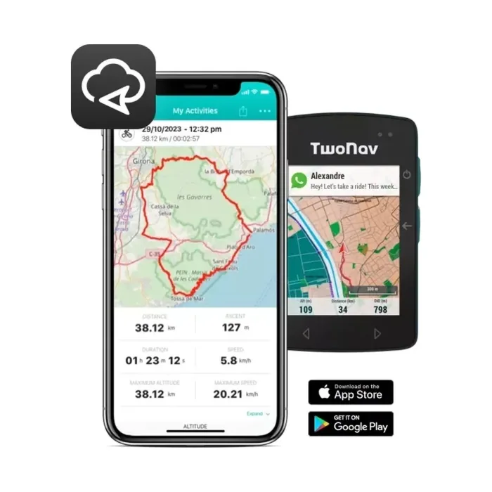
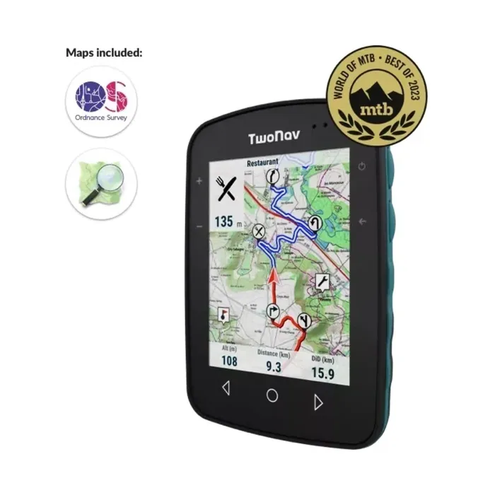
GPS TwoNav Aventura 2 Plus - A cutting-edge GPS with a large screen that’s resistant to extreme temperatures, perfect for extreme hiking and hiking. With a joystick and buttons to easily navigate maps. Includes topographic map.
One stop shop for complete navigation & communication solutions.
Catalogue
Handheld GPS for trekking and expedition use.
Catalogue
Outdoor Recreation · Showing 11 of 11 products
GPS TwoNav Aventura 2 Plus - A cutting-edge GPS with a large screen that’s resistant to extreme temperatures, perfect for extreme hiking and hiking. With a joystick and buttons to easily navigate maps. Includes topographic map.
GPS TwoNav Aventura 2 Plus Motor - A cutting-edge GPS for any driving activity. Large display so you can see the track on a motorcycle, quad or 4x4. Includes topographic map and road map for optimal dual on/off-road navigation.
GPS TwoNav Cross Plus - TwoNav's smallest GPS. Compact and handy navigator in one hand. Multisport GPS receiver, ideal for both hiking and cycling. Cross Plus is a versatile GPS designed to offer maximum reliability and endurance for your mountain activit
Explore Confidently with the Reliable Handheld GPS 2.2” sunlight-readable color display with 240 x 320 display pixels for improved readability Preloaded with TopoActive maps with routable roads and trails for cycling and hiking Support for GPS and GLONASS…
A wrist-worn outdoor GPS running on two AAA batteries, rated for up to 100 hours of normal use or 1,000 hours in expedition mode.
A floatable, AA-battery-powered handheld GPS with an IPX7-rated, high-impact plastic alloy housing.
An outdoor handheld GPS with a built-in rechargeable battery rated for up to 180 hours of runtime, or 840 hours in expedition mode.
Multi-Band GPS Handheld with Sensors Explore more with this rugged handheld that offers multi-band frequency support for our most accurate position to date, a 2.6” color display, and preloaded maps. Don’t miss a detail with this large, sunlight-readable color…
The Roc GPS is designed specifically for adventurous cyclists with high quality mapping. It offers essential safety features for challenging routes, ensuring you can handle unexpected situations with its clear display, detailed maps, and advanced navigation…
The outdoor navigator for adventure lovers who want to feel the thrill of exploring safely and without limits for all kinds of activities. For hiking, mountain biking, and water sports.
Handheld GPS units for trekking, expedition and survey work. ASPL has supplied handheld satellite navigation in India since the technology first reached the market, and services what it sells.
Outdoor recreation GPS devices are rugged, standalone navigators built for trekking, mountaineering, cycling and expedition use, where a phone's touchscreen, battery life and fragility fall short. They come in two physical forms: handheld units you hold or clip to a pack strap, and wrist-worn GPS watches that keep both hands free for trekking poles, a bike or a climb. Unlike a phone, these devices are purpose-built around GNSS positioning, preloaded topographic mapping and multi-day battery endurance rather than general computing.
The device's GNSS chipset listens for timing signals from satellite constellations such as GPS, GLONASS and Galileo, and calculates its position by measuring the time each signal took to arrive from multiple satellites simultaneously. That position is then plotted against topographic map data stored on the device itself, so the unit can show your location, elevation and surrounding terrain without needing a live data connection at any point. This is the key difference from a phone: a phone's maps are usually streamed or cached from the internet and its GNSS antenna is a small component sharing space and power with everything else the phone does, while a dedicated outdoor GPS is designed around the antenna, the battery and offline map storage as its primary job.
Before relying on any GPS device for a trip, give it time to complete a full cold-start satellite lock in open sky, away from buildings, dense tree cover or valley walls, which can take a few minutes the first time or after the device has been off for a long period; subsequent fixes are much faster once it has current almanac data. Load or confirm the maps and any planned routes or waypoints you'll need before you leave connectivity behind, since most of these devices can't download new map tiles or receive live data once you're out of cellular or Wi-Fi range. As a pre-trip checklist: confirm the battery is fully charged or carry the specified spare batteries or power bank, verify the correct offline maps for your route are actually loaded rather than just installed as a broader region pack, and do a short test walk to confirm the device is tracking and recording correctly before you're relying on it in the field.
No. GNSS positioning works by receiving timing signals directly from satellites, which is completely independent of cellular networks or Wi-Fi. As long as maps and routes were loaded onto the device beforehand, it will continue to show your position and surrounding terrain in areas with no phone signal at all, which is the main reason these devices exist for backcountry and expedition use.
In open sky, a modern phone and a dedicated GPS device can both achieve accuracy in the same general range, since both rely on the same satellite constellations. The difference shows up in difficult conditions: dense forest, narrow valleys or steep rock faces, where a dedicated device with a larger antenna and, on higher-end models, multi-band GNSS reception tends to hold a stable fix better than a phone's smaller, general-purpose antenna.
GPS is the US satellite constellation, but 'GNSS' refers to all the global satellite navigation systems together, including Russia's GLONASS and Europe's Galileo. A receiver that uses multiple constellations has more satellites available to lock onto at any given time, which generally means a faster initial fix and steadier accuracy in terrain where a signal from any single constellation might be partially blocked, such as narrow ravines or forested slopes.
This site uses only the cookies required for it to run, nothing for tracking or advertising. See our privacy policy.